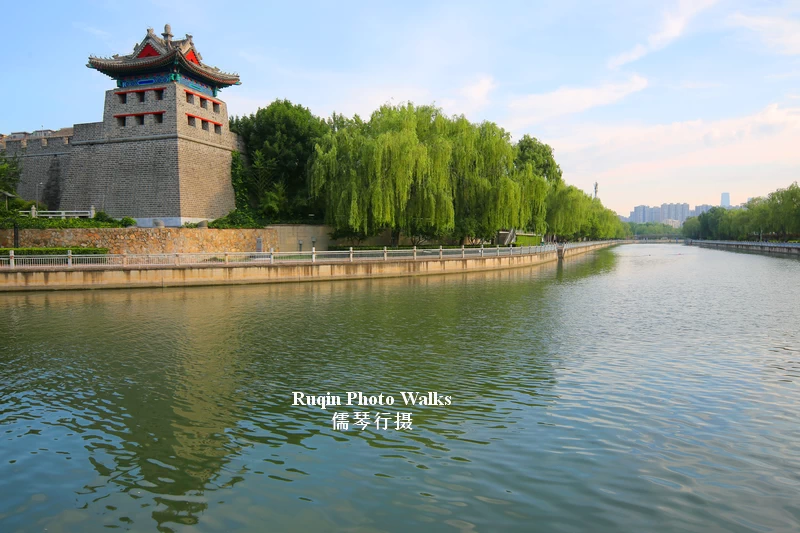

Written by Ruqin
June 10, 2026
Quick Walk Overview
Start: Exit B, Guangqumen Station (Subway Line 7)
End: Zuo’anmen Bridge
Distance: Approx. 4 km
Walking Time: 2–3 hours with photo stops (approx.)
Best Time: Early morning (7:00–9:00 am) or late afternoon
Surface: Flat paved greenway paths
Crowd Level: Very quiet early in the morning
This morning, June 10, 2026, I took Subway Line 7 to Guangqumen Station and began a walk that I had been looking forward to for some time. The temperature was perfect—about 16°C to 24°C—with soft sunshine and clear skies.
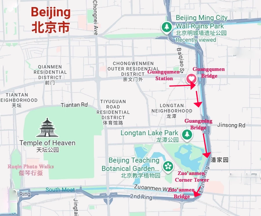
Route Map of My Walk Along the Beijing Second Ring Road Moat Greenway (Google Maps)
The route follows one of my favorite sections of the Beijing Second Ring Road Moat Greenway, a waterside walking and cycling route that winds beside Beijing’s historic city moat. Along the way, I passed joggers, fishermen, swimmers, retirees, and commuters beginning their day. More than a scenic walk, this route offers a glimpse into everyday Beijing life.
Why I Walked This Route
I often walk here when I want to experience a different side of Beijing.
The old city moat was originally built as part of the Ming and Qing Dynasty city defense system. Today, it has become something entirely different—a long green corridor filled with water, trees, exercise paths, and local life.
This walk also brings back memories of my years living in Ottawa.
For more than ten years, I regularly walked along Colonel By Drive beside the Rideau Canal. The atmosphere here reminds me of those mornings. People walk, jog, cycle, fish, and simply enjoy being outdoors. Although the cities are different, the feeling is surprisingly similar.
That combination of history, water, greenery, and ordinary daily life is what keeps drawing me back.
Step-by-Step Walking Route
Step 1: Guangqumen Station to Guangqumen Bridge
Distance: Approx. 1 km
Walking Time: Approx. 20 minutes
I exited from Exit B of Guangqumen Station and headed east along Guangqumen Inner Street.
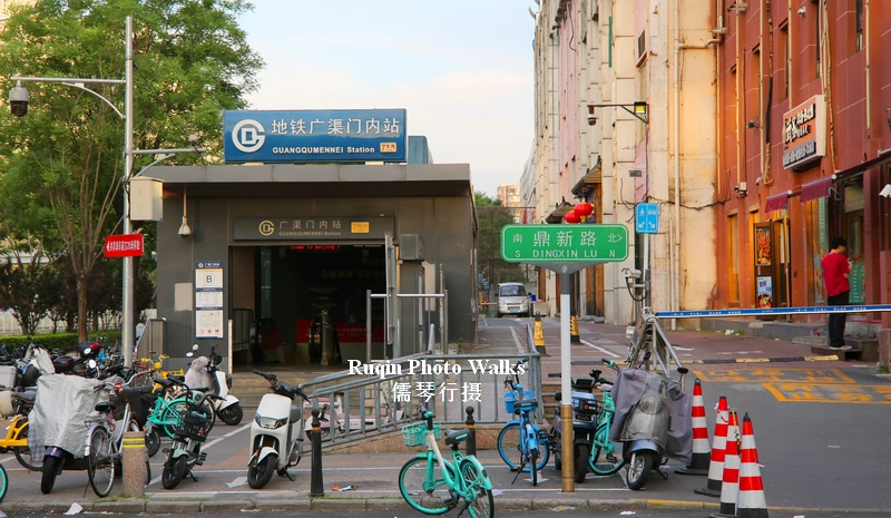
I exited from Exit B of Guangqumen Station
At this early hour, the city was still waking up. There were only a few pedestrians on the sidewalks. Delivery riders sped past on electric scooters, and the occasional bus rolled through the intersection.
As I approached Guangqumen Bridge, I climbed the pedestrian overpass for a wider view. Looking east, I could see the broad roadway stretching into the distance and the layered structure of Guangqumen Bridge ahead.
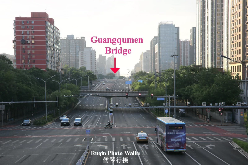
Standing on the pedestrian overpass for a wider view of Guangqumen Bridge in the east
After descending from the overpass and crossing one traffic light, I soon arrived at the bridge itself.
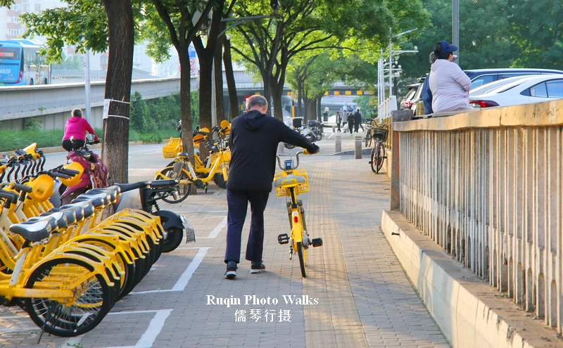
I was approaching Guangqumen Bridge
Guangqumen Bridge is one of the major interchanges on Beijing’s East Second Ring Road. It spans both the busy East Second Ring Road and the historic Southeast City Moat below.
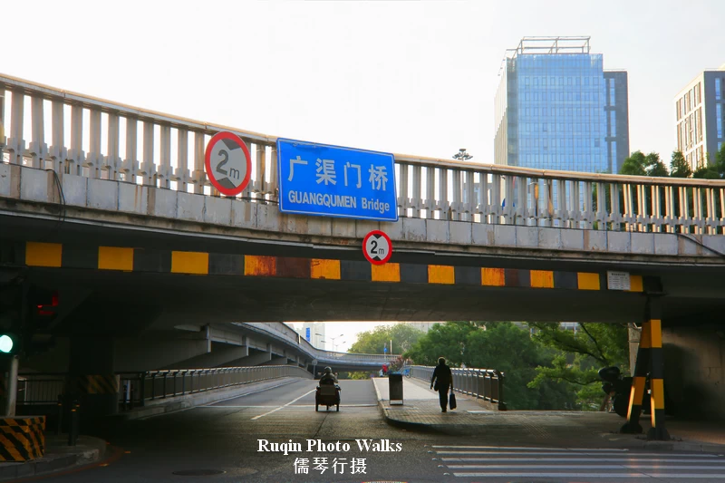
I’m about to cross Guangqumen Bridge.
The bridge takes its name from Guangqumen, one of the seven gates of Beijing’s Outer City built during the Ming Dynasty in 1553. Although the gate itself was demolished in the 1950s, the name survives through the surrounding neighborhood and bridge.
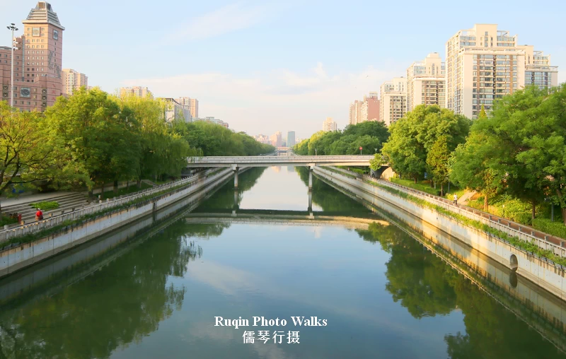
The Southeast City Moat viewed from the middle of Guangqumen Bridge
Standing midway across the bridge, I stopped for a few minutes to photograph the moat below. The water was remarkably clear, reflecting the morning sky and the trees along its banks.
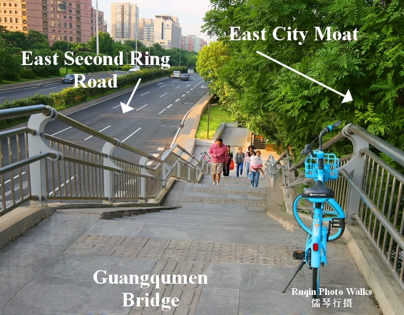
I walked down to the waterside path along the Beijing East City Moat
From Guangqumen Bridge, I walked down to the waterside path along the Beijing East City Moat, joining the Beijing Second Ring Road Waterfront Greenway.
Step 2: Guangqumen Bridge to Guangming Bridge
Distance: Approx. 950 meters
Walking Time: 20–30 minutes
The greenway immediately felt like a different world from the busy roads above.
The moat here is wide and surprisingly clean. Rows of willow trees line the banks, their branches hanging gently over the water. Flower beds, lawns, and shaded sitting areas create the feeling of a large waterside garden.
This section forms part of the larger Beijing Second Ring Road Greenway, a continuous route of approximately 44 kilometers around the second ring road in the city center.
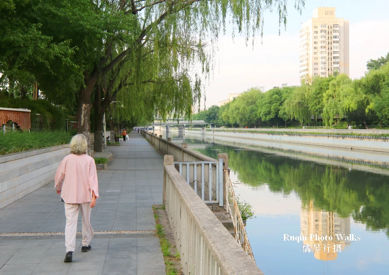
The moat here is wide and surprisingly clean
In recent years, Beijing has gradually connected its waterfront pathways, urban greenways, and pedestrian systems into a single network – Beijing Greenway. The result is a route where walkers and cyclists can travel long distances without constantly encountering major road barriers.
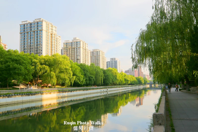
This section forms part of the larger Beijing Second Ring Road Greenway
Along the path, I noticed fitness equipment, benches, accessible ramps, restrooms, informational signs, and plenty of shaded areas.
Across the moat, the waterfront path looked like a well-kept garden. Flower beds and neatly trimmed bushes lined the walkway, while stone steps linked the streets above to the greenway below. In several places, steps descended directly to the water, allowing swimmers easy access to the moat.
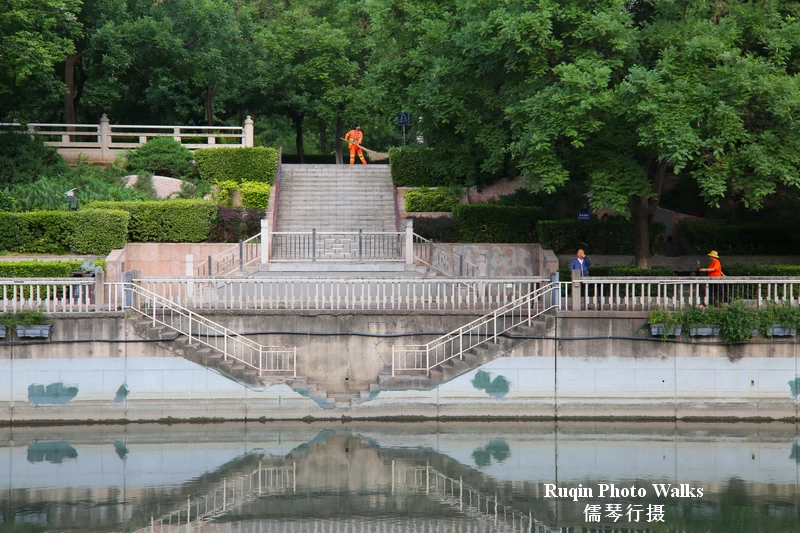
Across the moat, the waterfront path looked like a well-kept garden
Even at this early hour, local residents were already out enjoying the space. Some walked briskly, others jogged, and a few sat quietly on benches looking out over the water.
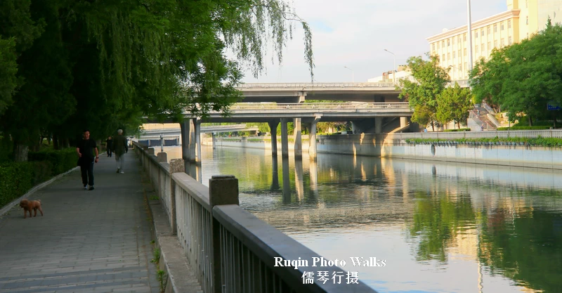
I’m approaching Guangming Bridge ( Brightness Bridge)
A short while later, I arrived at Guangming Bridge, one of the 32 major interchanges along the Second Ring Road.
Step 3: Guangming Bridge to Zuo’anmen Bridge
Distance: Approx. 2 km
Walking Time: 30–50 minutes
After passing beneath Guangming Bridge, I continued south along the eastern bank of the moat.
Soon I reached Longtan Floodgate.
Longtan Floodgate
This structure plays an important role in regulating water levels within the city moat system, particularly during Beijing’s summer rainy season. During periods of heavy rainfall, it helps control water flow and reduce flood risks.
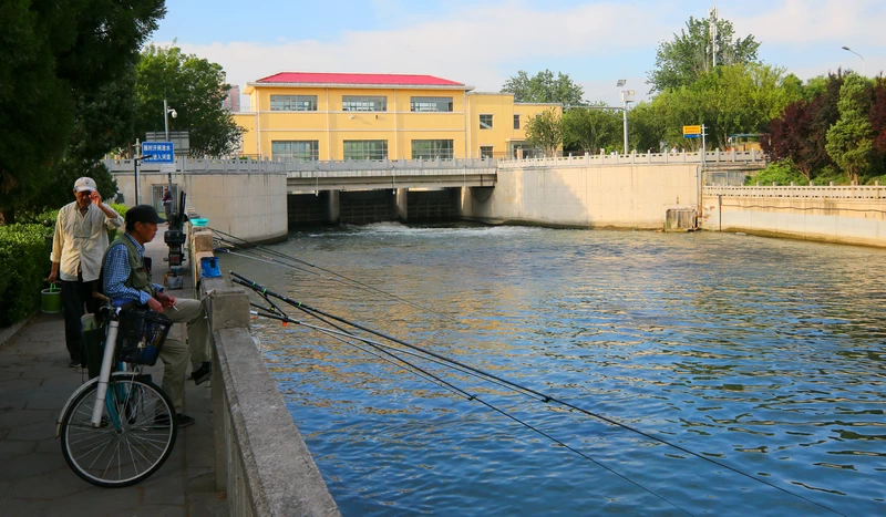
I saw a few people fishing near the Longtan Floodgate
I saw a few people fishing near the Longtan Floodgate. As I continued walking, I noticed many more anglers scattered along the moat. Most appeared to be retirees. Some sat alone, while others chatted with friends as they waited patiently for a bite. Fishing seemed less about catching fish and more about enjoying the morning.
The improvement in water quality over recent years has brought more fish back to the moat, making it a popular fishing spot for local residents.
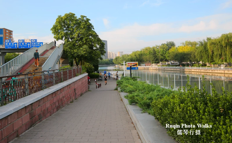
After walking around the floodgate, I returned to the waterside path
After walking around the floodgate, I returned to the waterside path and encountered something I had not expected.
Swimmers.
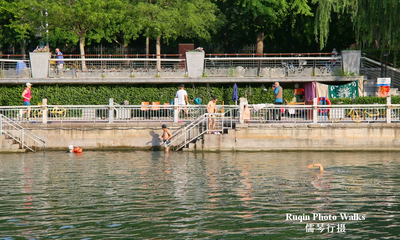
A number of local residents were already in the water
A number of local residents were already in the water, swimming in designated areas of the moat. The city has invested considerable effort into improving the water environment here, and many people now use the moat for recreation. Along the shoreline, there are simple changing facilities and safety signs for swimmers.
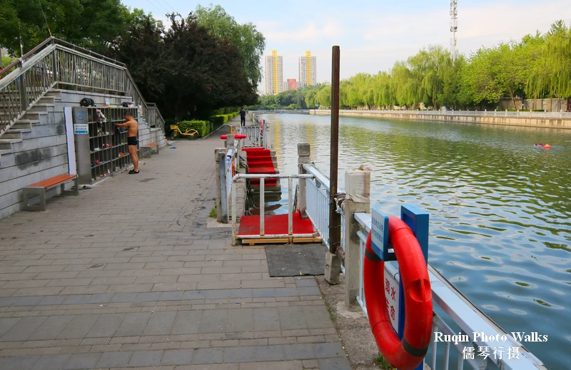
One of the designated areas of the moat for swimming
The wider sections of water also attract more anglers, creating a lively but relaxed atmosphere.
Watching the fishermen, swimmers, joggers, and morning walkers together, I was struck by how much this historic moat has evolved. What was once a defensive barrier protecting the city has become a public space shared by everyone.
Further along the East City Moat, I came across even more fishermen enjoying the quiet morning by the water.
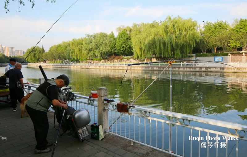
I came across even more fishermen enjoying the quiet morning
In many ways, it feels like a free outdoor community park stretching through the heart of Beijing.
To the east lies Longtan Lake Park, another popular destination for local residents. Several pedestrian connections allow visitors to easily move between the greenway and the park.
Zuo’anmen Corner Tower
As I approached the point where the East City Moat meets the South City Moat, I came upon the reconstructed Zuo’anmen Corner Tower.
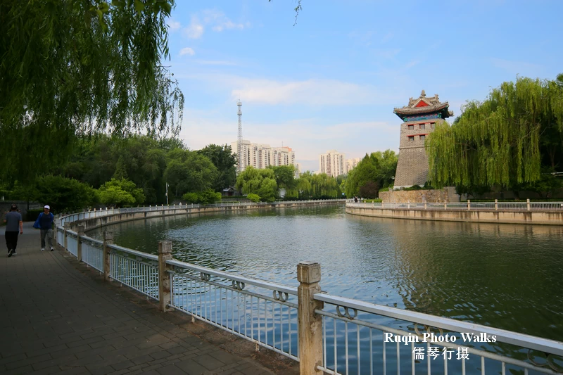
Zuo’anmen Corner Tower: the East City Moat meets the South City Moat
Originally built in 1553 as part of Beijing’s Outer City defenses, the tower collapsed naturally during the early twentieth century. It was reconstructed in 2015 and later reopened to the public as theCorner Tower Library.
The tower provides an interesting historical landmark at the bend in the moat and makes a natural photo stop along the route.
Zuo’anmen Bridge
From there, it was only a short walk to Zuo’anmen Bridge.
The bridge takes its name from Zuo’anmen, or “Left Peace Gate,” one of the former gates of Beijing’s Outer City.
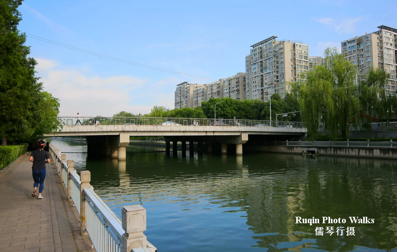
Zuo’anmen Bridge
In early spring, this area becomes especially popular because of its plum blossoms, which attract photographers and local visitors alike.
What the Area Feels Like Right Now
This morning, the waterfront greenway felt calm, healthy, and full of life.
The water was clean. The trees provided generous shade. Birdsong often replaced traffic noise.
Most people I encountered were local residents rather than tourists.
Some were exercising.
Some were fishing.
Some were swimming.
Others simply sat by the water and watched the morning unfold.
What I enjoy most about this route is that it doesn’t feel designed primarily for visitors. It feels designed for the people who live here.
That authenticity is increasingly rare in large cities.
Practical Tips
- Start early to enjoy cooler temperatures and softer light.
- Bring a telephoto lens if you enjoy photographing people engaged in daily activities.
- Several public restrooms are available along the route.
- Benches and shaded areas make the walk suitable for a relaxed pace.
- Spring is especially beautiful when plum blossoms bloom near Zuo’anmen.
- The route is suitable for walking, jogging, and cycling.
- Longtan Lake Park is an easy extension if you wish to continue exploring.
Why I Keep Coming Back
Every time I walk here, I notice something different.
Sometimes it’s the reflections on the water. Sometimes it’s an elderly fisherman patiently waiting for a catch. Sometimes it’s the contrast between modern Beijing above and the centuries-old moat below.
What I enjoy most is that this waterside route never feels like a tourist attraction. It feels like part of the city’s daily rhythm. Walking here reminds me that Beijing’s history isn’t confined to museums or famous landmarks—it continues to exist in the ordinary places where people gather, exercise, relax, and enjoy the outdoors.
Last Walked On: June 10, 2026
Further Reading
Beijing City Walks: Routes, Maps & Essential Travel Tips
Beijing Hutong Walks: Routes, Maps & Local Tips
Beijing Ming City Wall Relics Park Morning Walk | Beijing Photo Walks by Ruqin
Early March Morning Around Shichahai — Beijing Photo Walks by Ruqin
Where to Run in Beijing: Best Routes, Parks & Running Tips